Click on some Santana, Top Gun, Bob Marley, Rocky, AC/DC, Mission Impossible,
Beach Boys, Axle's Theme, James Bond, Van Halen, or the Eagles while you browse this report.
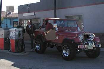
On Sunday August 25th, Bill 'Hobo Willy' Hallinan and his Jeepin' sidekick Molly, Chris 'Colonel' Potter and sons Jason, Michael and Scott, and I (Drewby Dooby Doo) met at the Bugling Bulls restaurant in Conifer for a trip up Georgia Pass to the Continental Divide. That is to say, we tried to meet at the Bugling Bulls. It turns out that the landmark restaurant is no longer in business; it's now the Elk Grove restaurant. Okay, whatever, it takes more than that to discourage Jeepers from heading into the mountains on a beautiful summer day. So we drove from Conifer to Jefferson, where we aired down and gassed up before turning west onto CR35.
|
|
| Bill chats with the VERY talkative gas station attendant in Jefferson... |
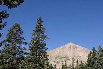
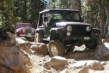
The blacktop quickly gave way to dirt, where I kindly reminded the rest of our group why it's so good to be the lead dog; if you're not, the view never changes. But we let ourselves get a little spread out, and the dust wasn't too bad. Not long after beginning our ascent into the mountains, Bill found out the hard way that Molly REALLY had to go. But after a quick canine 10-100 later, we were on our way again. The eastern side of Georgia Pass is an easy drive, and we quickly reached the 11,585-foot top of the pass.
|
|
| It's good to be the trip leader for once. 'Eat my dust, Bill'.… |
|
|
|
|
Only in Colorado can the sky be this blue… |
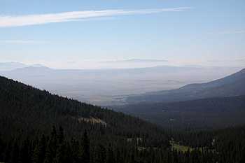
View of South Park from the top of Georgia Pass… |
|
|
|
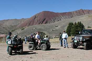
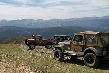
The Hobos on top of the pass… |
There we stopped for some pictures and to talk to a couple of guys coming down off Glacier Ridge on their ATVs. One of the riders pulled up next to me and said, "Hey, how's it going?" I told him that we were having a good trip, to which he responded, "You don't have any idea who this is, do you?" Okay, the voice was familiar, but it wasn't until he took off his full-face helmet that I realized it was my friend and coworker, Ken Wahl, along with his son Kalen. The ATVs were Ken's newest toys, supplementing the personal watercraft and snow machines. Heck, if he sold them all, he could probably afford a nicely modified Jeep! Ken, Kalen, and their friends had ridden up the pass the day before and camped overnight. We chatted a little, took some more pictures, and then the ATVs headed down the pass while the Jeeps headed up Glacier Ridge.
|
|
|
Fancy meeting you here! (had to be there) |
|
|
|
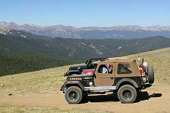
Breckenridge (left of center) as seen from the top of Glacier Ridge… |
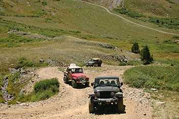
I'd never been up Glacier Ridge before, but Bill had warned me that it's known for being a little off-camber. He wasn't kidding. The conditions were perfect and traction wasn't a problem, but I'm not sure I'd want to run that trail after a good soaking rain. But after a while, you get used to being wedged against your driver-side door, and the outstanding views of Summit County and Breckenridge make it all worthwhile.
|
|
|
Did I mention that it's a little off-camber ? (This shot is my perspective~30degrees) |
|
|
| Really - it's a little off-camber! |
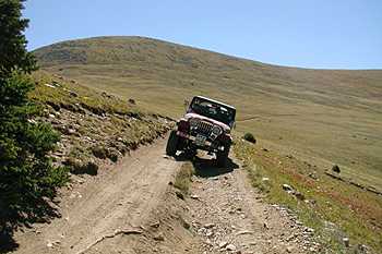
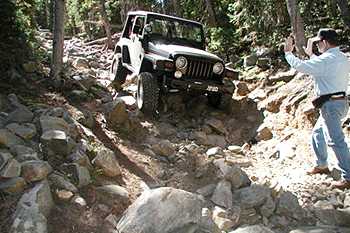
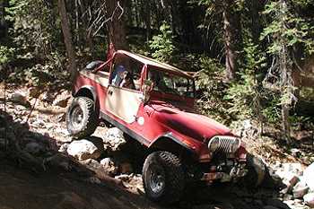
As they say, "What goes up must come down." That's true of airplanes, tech stocks, and Jeep roads. In our case, coming down could only mean one thing: SOB Hill. This short but steep section of trail descends a wooded hillside, and is strewn with boulders that rival the rock gardens of Spring Creek and Battlement Mesa. I'm not sure a vehicle could climb the hill with anything less than 35" tires (or a lot of rock stacking), but we suspected that we'd make it down okay with our lockers and 33s. Under the careful direction of Chris' spotting, I proceeded down.
|
|
|
Drew gets flexed as he starts down the hill… |
I neared the bottom, but I was overtaken by a group of dirt bikers. They were having a tougher time than I was, mainly because their bikes couldn't stay running due to the steepness of the descent. But they came down a makeshift go-around with their back wheels pretty much locked up and got by me without too much trouble. The go-around, while passable for now, will likely erode away in the not-too-distant future and become just as difficult as the original trail. This is no solution. Look, if the trail is too difficult, don't go around; go back. Driving off the trail and making your own path through the woods is a good way to get trails closed. Tread lightly. At any rate, I completed my descent without any major problems, thanks in large part to an excellent spotting job.
|
|
|
|
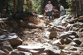
The rocks seem to get bigger the farther down you go. |
Chris tells Drew to take it 'nice and slow'… |
|
|
|
Bill and Chris ponder which line will result in the best Kodak moments… |
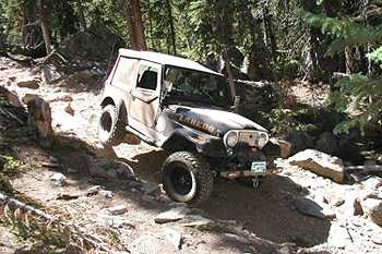
The Colonel then guided Bill down, helping him get just tippy enough in one section for a great photo, but never putting him at any real risk of rolling. Bill then took his turn as spotter for Chris, while Jason and I recorded the moment on film. As usual, the pictures can't show the true steepness of SOB Hill. Believe me, it earns its name. But we all made it down successfully, with only the occasional sound of metal on rock.
|
|
|
Bill's CJ-7 gets a little tippy here, but rides it out… |
|
|
|
|
For once, Bill didn't feel the need to roll rocks out into the trail to make it tougher… |
Molly knows where the camera is, as she 'strikes a pose'… |
|
|
|
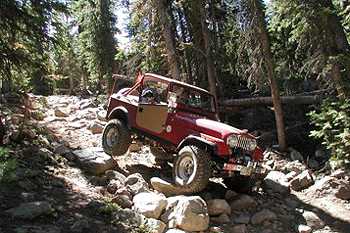
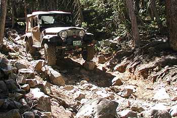
Now it's Chris's turn to descend S.O.B. Hill, it's even steeper than it appears in this picture… |
|
|
|
|
Chris takes the perfect line and avoids the sound of metal on rock… |
Just remember, "What goes up must come down.", as the Colonel shows off his flex appeal… |
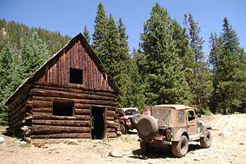
Once out of the woods, so to speak, we continued down into the valley, and then began the ascent back up the other side. After a short time, we came to an old cabin that looked like it would be a great spot for lunch. Eating in the shade next to the cabin, we met several of the local residents. While Molly preferred chasing the squirrels, Scott and Michael decided that lunch was for the birds. The twins happily gave up cracker after cracker, much to the delight of the mountain jays.
|
|
|
This well-preserved log cabin at Swandyke, one of many that we saw, served as our lunch spot… |
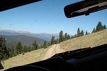
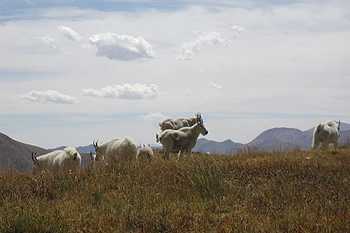
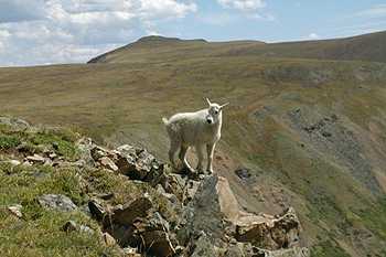
After lunch, we headed up the opposite side of the valley we had just descended, and soon found ourselves above treeline again. We took a quick side trip up Wise Mountain, where a family of mountain goats was grazing. They were kind enough to pose for a few pictures before moving on.
|
|
|
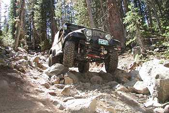
Climbing a loose, steep section. You can see the road crossing the valley floor below and behind us… |
|
|
|
|
A family of mountain goats, stocking up for the upcoming winter near Wise Mountain… |
"Hey mom, look at me!" |
|
|
|
Another view of Breckenridge, this time from the top of Wise Mountain… |
|
|
|
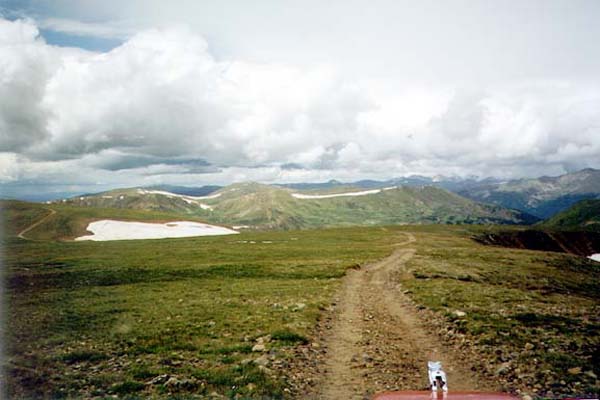
This is Colorado! One of the best scenic tundra trails close to Denver! Please stay on roads and parking areas off the tundra. (photo taken in August 1999, note snow--not this year) |
Then it was time for us to head back down. Our final descent brought us past the Wild Irishman mine at St. John's, and finally onto pavement in Montezuma, next to the River Run Gondola at Keystone. After getting some air and gas in Keystone, Bill headed west for a few days of camping. The Potters and I headed east over Loveland Pass and back to Denver, with memories of another great day of Jeeping in the Rockies.
|
|
| One last steep climb before the descent into Montezuma… |
|
|
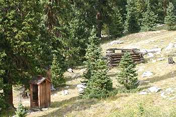
| They built the most important building a little better than the rest… |
"Jeep, Jeep,"
Storyline & captions by Drew 'Drewby Do' Middleton HoboJeepers
*Web design by Hobo Willy, Thanks to Drew Middleton for the photos...
Here are some other Trip Reports in the area:
Red Cone to Georgia Pass 2001: The HoboJeepers
Red Cone to Georgia Pass 2000: The HoboJeepers
Red Cone/Radical Hill/Swan/SOB Hill/Glacier Ridge-All-4-Fun 99': The HoboJeepers
Red Cone Trail 99'-HoboJeepers
Red Cone Trail Map by 4x4trails.net
Co Sports.Com Webster Pass/Radical Hill
Georgia Pass/S.O.B. Hill by Flatlander
![]()


![]()
Jeep is a registered trademark of Daimler Chrysler Corporation
![]()