|
|
| The ticket to'ride' the day's trail... |
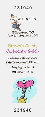
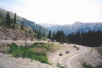
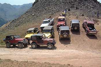
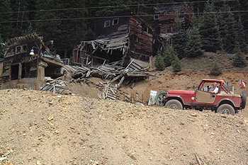
On Tuesday July 30th, the crisp frosty morning from a clear night slowed things a bit getting ready. But at 9am on staging area 'B', the Jeepers were ready to explore Brown's Gulch/Corkscrew Gulch/Ross Basin/Colorado Basin Trails. These Jeepers behind me were: Ed Cruess (Toyota), Ireson (Cherokee), Rick Fitzsimmons (Bronco), Scott & Justine Marshall (CJ7), Justin Olsen (TJ), Jeff Carr (CJ7), Scott Lindsay (CJ5), Bobbette Mathews (TJ), Rob Evans (Toyota), Eric Smoultz (Ranger), Rick Lewis (CJ7), & Tom White (TJ).
|
|
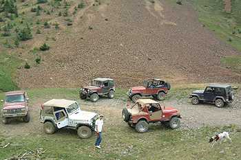
| Staging 'B' at 9am for a great day on the trail in the San Juan's!. |
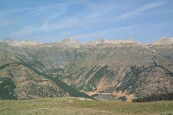
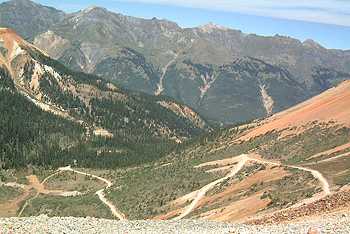
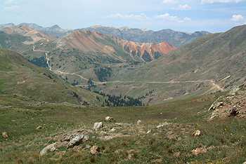
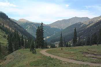
At 9am, we paraded thru Silverton south to Hwy 550 and west out of town. We reached the Brown's Gulch trailhead and made our way up the trail for a 10-100. Soon after climbing up Brown's Gulch, the trail reaches above timberline and levels off for some of the best views of the western San Juan's. The morning sun shined bright on 13,661' Lookout Peak and the Black Bear trail to the West.
|
|
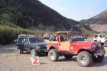
| A quick re-org at the trailhead off Hwy 550... |
|
|
|
|
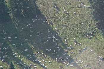
Sheep dot the hillside... |
Nice views! Looking west (Hwy 550 below, Black Bear Pass upper right)... |
|
|
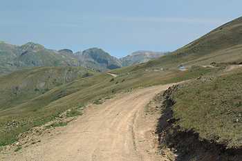
| The trail was easy, but you can't beat the views! |
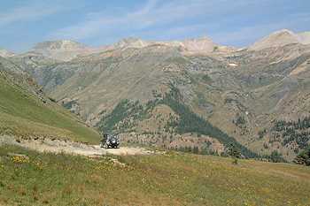
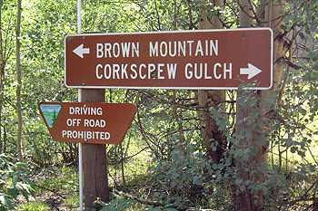
We dropped back down into the trees and worked our way back to near Red Mountain Pass and Hwy 550. The trail is quite easy, but the scenery more then makes up for it. Re-grouping at Red Mountain Pass for a group photo, we headed north on Hwy 550 for a few miles to the Corkscrew Gulch trailhead near the ghost town of Ironton.
|
|
|
Heading back down to Red Mountain Pass... |
|
|
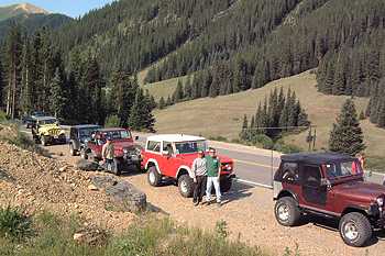
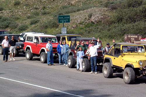
| A fun group to led! Waves from red Mountain Pass on Hwy 550... |
|
|
|
|
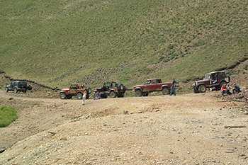
Group vehicle shot... |
Parading down the switchbacks to the Corkscrew Gulch trailhead... |
|
|
|
Take a right for 'fun'... |
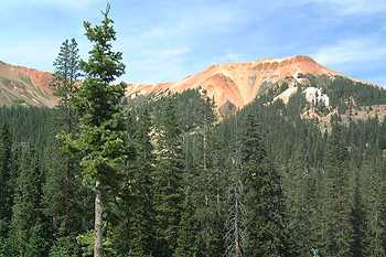
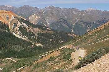
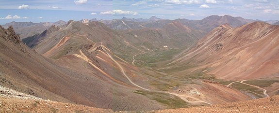
Corkscrew Gulch is only rated moderate because of it's steep narrow switchbacks near the top. Near the bottom of the gulch, the trail can be quite tricky to drive if it's wet as clays can send you down the gulch. This trail reaches it's highest point between Red Mountain 1 and 2 over 12,000+'. Numerous mines dot the gulch, and the red-colored creek and rocks show testament to the iron-rich soils and rocks in the area weathered over time. We stopped for lunch at the pass with excellent views of the Gladstone area and Ross basin.
|
|
| This shale/clay section gets mighty slick in the rains... |
|
|
|
|
Iron-oxide stained mountains surround you... |
Jeepers up the 'Corkscrew'... |
|
|
| The many switchbacks of Corkscrew Gulch... |
|
|
|
Finally, you level off... |
|
|
|
Here is were we stopped to have lunch... |
After lunch, I took some over to another viewpoint that looks off to the West and exposes Red Mountain 1 & 2 in all their brilliant reds and other colors. Many kodak moments later we headed back down to the pass and the rest of the group. We started down towards Gladstone and the end of the official trip. Some headed back to camp while I led some others over to Ross Basin and some awesome views!
|
|
| Views like the one below were everywhere from this parking area... |
|
|
| What a great group of 'guys'...a classic view of Red Mtn. 1 & 2. |
|
|
|
|
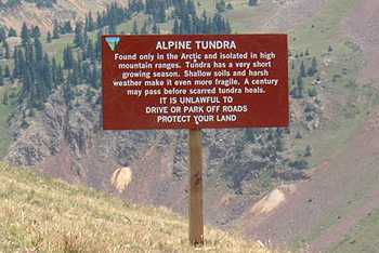
Please stay on established trails and parking areas... |
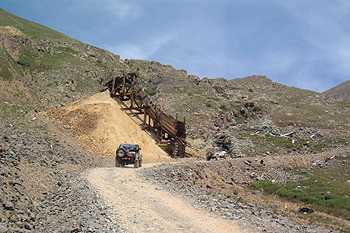
A well-preserved dump chute... |
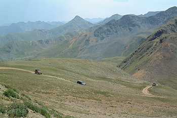
Taking a left, then east off the road leading to Hurricane Pass, we climbed up Ross Basin past some mines on up to a saddle at ~13,200' just below Hurricane Peak. Another awesome view! Looking north, you could look right down California Gulch and the Pass. One of the top 5 views I'd say! After a group shot, I retraced our tracks back out of Ross Basin down to Gladstone. Some others headed back to camp while the diehards looked for more!
|
|
| Another great view looking west from Ross Basin... |
|
|
|
|
The last tight switchbacks... |
San Juan beauty everywhere... |
|
|
|
California Gulch looking North from a saddle high above Ross Basin... |
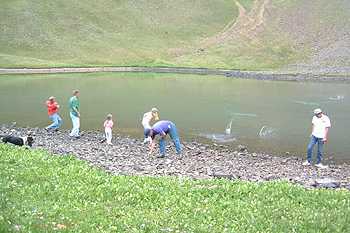
Above Gladstone is a series of mines up every gulch. I headed 1st up to the end of Colorado Basin at 11,250' to a lake at the base of a huge u-shaped bowl. Echos can be made, and all tried their hand at rock-skipping. Then it became a contest to 'bomb' some poor flower caught on the lake. Fun no the less...
|
|
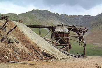
| I led the group past the Lead Carbonate Mill at Gladstone... |
|
|
|
|
We stop at the top of Colorado Basin... |
and skip some rocks... |
|
|
|
The view down Colorado Basin... |
Since the objective was to find some nice ore rocks, I headed up to Minnehaha Basin and the Minnehaha Mine. We pounded on some rocks, but none of real value. Just across the valley was the Lead Carbonate Mine where there was a nice ore pile found by Cory Marshall with some nice showings of Lead and Pyrite minerals.
|
|
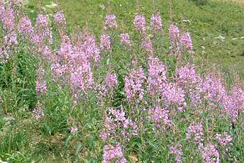
| These purple flowers were the only real color, most not surviving the drought... |
|
|
|
|
A look at Minnehaha Basin... |
Stopping to pound some rocks... |
|
|
|
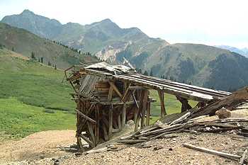
The Lead Carbonate Mine... |
|
|
|
another view looking south... |
Since it was getting late in the afternoon, we all headed down county road 10 towards Silverton and back to camp. At 7pm, the Bestop sponsored Ice Cream Social was to begin. Thanks to Bestop for their support of All-4-Fun 2002 and the great ice cream! Another FUN day! Tomorrow is Manufacture's Day, and a chance to relax in the San Juan's of Colorado!
Bill Hallinan HoboJeepers
Other All-4-Fun 2002 Trip Reports
Sat: Kendall Mtn. Sun: POWER GULCH TOUR Mon: Cinnamon Pass/Carson Townsite
Tue: Brown's Gulch/Corkscrew Gulch/Ross Basin/Colorado Basin
Wed: Manufacture DayThur: Black Bear Pass/Imogene Pass Fri: Stony Pass/Kite Lake
![]()

![]()
Jeep is a registered trademark of Daimler Chrysler Corporation
![]()